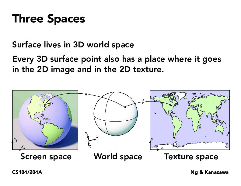
There's at least three different ways to flatten the globe (for cartography, at least - Mercator, Peters, Azimuthal polar), and each has its own set of distortions in either shape or size. I'm guessing the concerns would be different for graphics of other spherical objects that aren't globes, but is there a go-to projection used for going from world space to screen/texture space?
ja5087
I looked into this into the context of online street maps a little bit. I'm sure we all noticed at some point that zooming out of Google Maps now produces a 3D image like in Google Earth before it (ref). Apparently, they chose Mercator because it preserves angles, and most users are looking at the street level.
alexkassil
You might also find https://en.wikipedia.org/wiki/Map_projection this article interesting for all sorts of Map projections!
anthonytongUCB
There must be some sort of boundary we have to draw between things that are in 3D space vs texture right? Some things may be such a texture that it is in fact more appropriate to represent them in the 3D space?
rollororo
What are other use cases of turning projecting 3D objects to 2D space besides easier visualization?
There's at least three different ways to flatten the globe (for cartography, at least - Mercator, Peters, Azimuthal polar), and each has its own set of distortions in either shape or size. I'm guessing the concerns would be different for graphics of other spherical objects that aren't globes, but is there a go-to projection used for going from world space to screen/texture space?
I looked into this into the context of online street maps a little bit. I'm sure we all noticed at some point that zooming out of Google Maps now produces a 3D image like in Google Earth before it (ref). Apparently, they chose Mercator because it preserves angles, and most users are looking at the street level.
You might also find https://en.wikipedia.org/wiki/Map_projection this article interesting for all sorts of Map projections!
There must be some sort of boundary we have to draw between things that are in 3D space vs texture right? Some things may be such a texture that it is in fact more appropriate to represent them in the 3D space?
What are other use cases of turning projecting 3D objects to 2D space besides easier visualization?