This video talks about the 3D reconstruction of Google Earth: https://www.youtube.com/watch?v=suo_aUTUpps.
It describes the amazingly huge process of constructing a mesh of the entire planet. The logistics of stitching images from different sensors at different times and from different layers of the Earth's atmosphere to form a cohesive mesh is ridiculous. One engineer describes the process of removing cars from city images to more easily enable mesh generation. Simply amazing. Who knows where this technology will take us? This paper describes an implementation of using a 3D reconstruction for localization of a camera: https://www.di.ens.fr/~josef/publications/Sattler17.pdf. In the conclusion, the authors note that although 3D models provide more precise location estimations for a given image, their complexity and maintenance costs may make them unwieldy. Google Earth seems to be making the first steps towards creating a global autonomous system capable of maintaining an accurate up-to-date 3D reconstruction of the entire world.
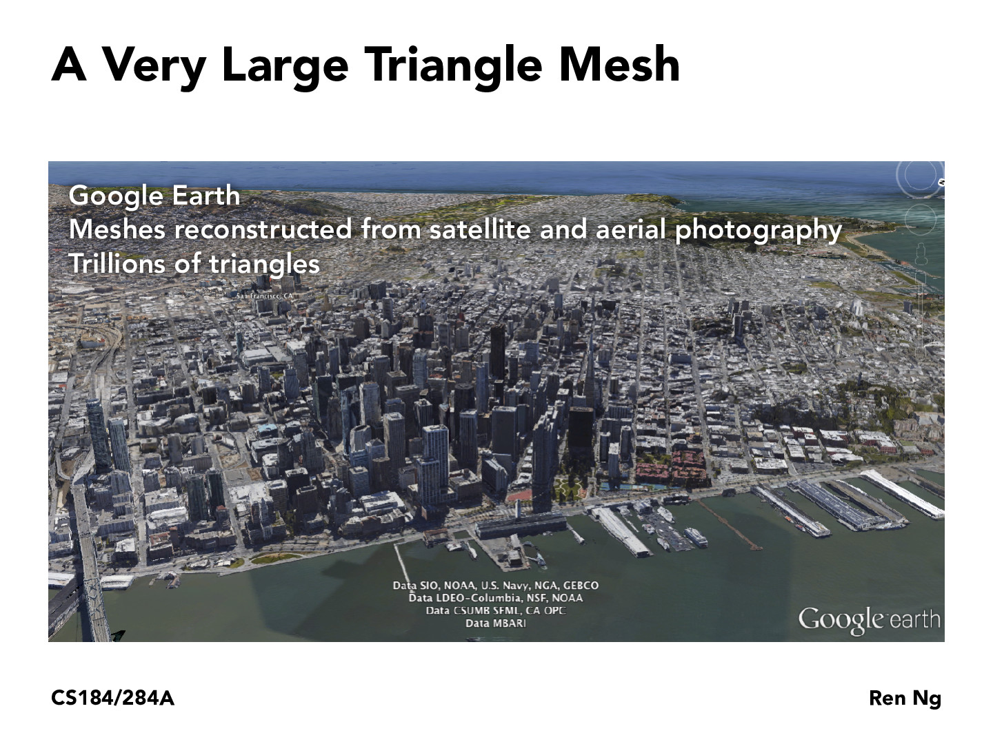
This video talks about the 3D reconstruction of Google Earth: https://www.youtube.com/watch?v=suo_aUTUpps. It describes the amazingly huge process of constructing a mesh of the entire planet. The logistics of stitching images from different sensors at different times and from different layers of the Earth's atmosphere to form a cohesive mesh is ridiculous. One engineer describes the process of removing cars from city images to more easily enable mesh generation. Simply amazing. Who knows where this technology will take us? This paper describes an implementation of using a 3D reconstruction for localization of a camera: https://www.di.ens.fr/~josef/publications/Sattler17.pdf. In the conclusion, the authors note that although 3D models provide more precise location estimations for a given image, their complexity and maintenance costs may make them unwieldy. Google Earth seems to be making the first steps towards creating a global autonomous system capable of maintaining an accurate up-to-date 3D reconstruction of the entire world.